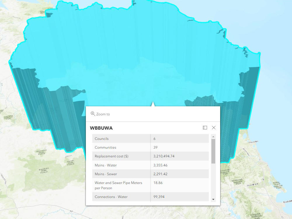
Coinciding with the refunding of the Queensland Water Regional Alliances Program, the QWRAP team have released the new interactive QWRAP regions hub. Many people have asked the location of the various QWRAP regions and how many communities and connections they serve. The team have designed this interactive platform based on ESRI’s online maps for external users.
The QWRAP regions hub allows users to explore the various QWRAP groups. By exploring the map, users can understand the number of councils involved with each region along with various other important information such as;
•Number of Communities
•Region Replacement Cost
•Length of Water and Sewer Mains
•Number of Connections
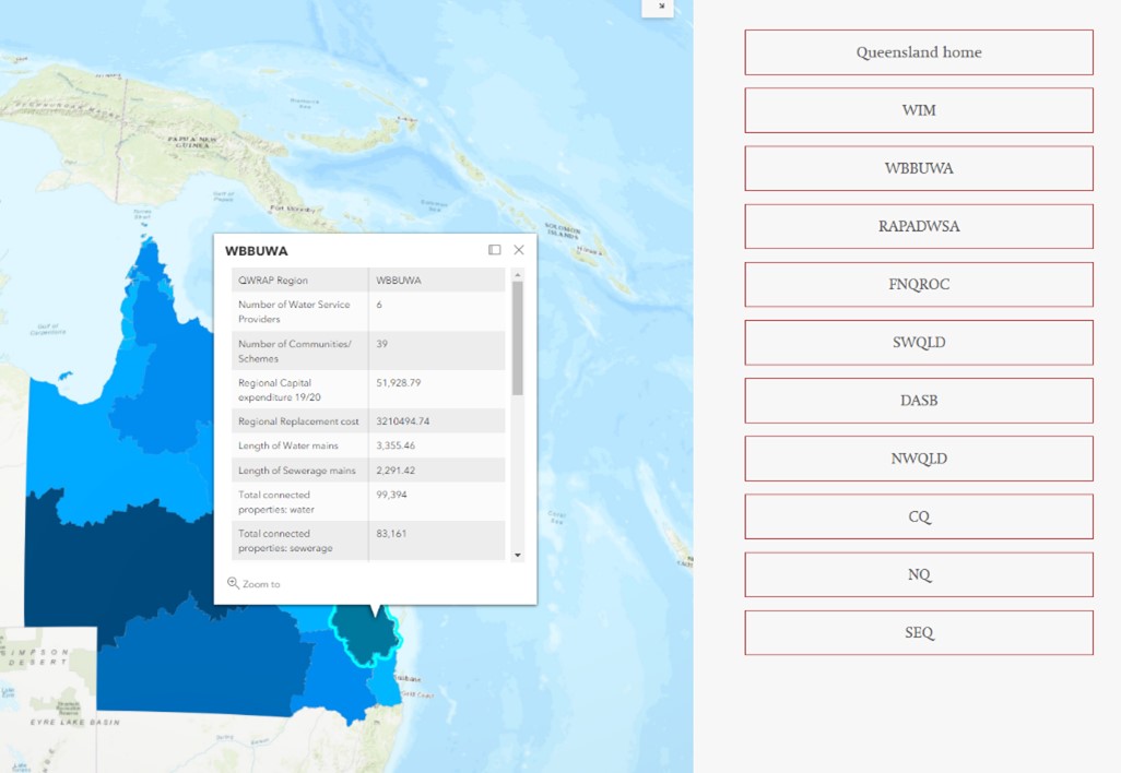
The team will continually update these pages as more data becomes available or is requested. The eventual end goal of this page is to allow comparisons across the regions…. Until then this is only a taster of what is possible.
Additionally the Regional Maturity page has been updated to align with the new SWRED and DASB regions.